What Is Atlas.co
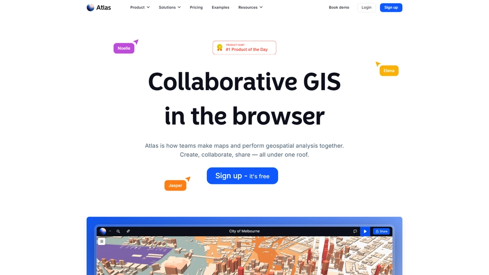
Atlas.co is a cutting-edge collaborative GIS and mapping platform designed to streamline the way teams interact with geographic data. Developed by Atlas, this browser-based solution empowers users to build, share, and edit maps in real time, bringing a new level of interactivity and collaboration to geographic information systems.
The platform addresses the growing need for easy-to-use, accessible mapping tools that facilitate team collaboration. By enabling users to visualize data and explore geographic insights interactively, Atlas.co enhances decision-making and analysis across various industries. Whether you're in urban planning, logistics, or environmental science, Atlas.co offers a seamless experience for understanding spatial data.
At the core of Atlas.co is its robust AI technology that simplifies the handling of complex geographical datasets. This integration allows users to incorporate innovative features like 3D models directly into maps, bringing additional layers of context and depth to visualizations. It's a significant advancement for professionals who rely on precise and comprehensive spatial analyses.
Targeting a diverse audience, including urban planners, researchers, and business analysts, Atlas.co democratizes mapping by making sophisticated GIS capabilities readily accessible. Its browser-based nature ensures that teams can collaborate from anywhere, making it an ideal solution for organizations looking to enhance their geographic insights without the hassle of cumbersome software.
Atlas.co Features
Atlas.co is a collaborative GIS and mapping platform that allows users to build, share, and edit maps in real-time while visualizing data and exploring geographic insights. The following are its key features:
Core Functionalities
Atlas.co enables users to collaboratively create and manage maps through an intuitive browser-based interface. Key functionalities include:
- Real-Time Collaboration: Users can edit and share maps simultaneously, facilitating seamless teamwork and communication.
- Interactive Visualizations: Offers engaging ways to visualize geographic data, making insights easy to understand and analyze.
3D Model Integration
Atlas.co supports the integration of 3D models into maps, enhancing the visual and analytical depth of geographic data:
- Effortless Uploads: Users can easily upload 3D models to their maps, allowing for a richer representation of spatial data.
- Improved Visualization: The addition of 3D models provides a more realistic view of the terrain and built environments.
Data Handling and Analytics
The platform offers robust tools for handling and analyzing geographic data:
- Comprehensive Formats: Supports various data formats, ensuring flexibility and compatibility with different data sources.
- Geographic Insights: Features analytical tools that help users derive meaningful insights from complex datasets.
Automation Capabilities
Atlas.co incorporates automation to streamline repetitive processes:
- Smart Tools: Automates tasks such as data updates and visualization refreshes, saving time and reducing manual effort.
Benefits to Users
Atlas.co offers multiple advantages to its users, enhancing productivity and decision-making:
- Enhanced Collaboration: Facilitates effective teamwork with real-time editing and sharing.
- User-Friendly Interface: Designed to be accessible, allowing users of varying technical expertise to navigate and utilize its features effectively.
Overall, Atlas.co stands out by combining advanced GIS functionalities with user-friendly design and collaborative tools, catering to teams that require detailed geographical insights.
Atlas.co FAQs
Atlas.co Frequently Asked Questions
What is Atlas.co?
Atlas.co is a collaborative GIS and mapping platform that allows users to build, share, and edit maps in real-time, visualizing data and exploring geographic insights interactively.
How can users share maps with their team?
Users can share maps by inviting team members to collaborate in real-time, allowing everyone to make edits and visualize data collectively.
What formats does Atlas.co support?
Atlas.co supports various formats that can be found on their formats page, providing flexibility in data integration and visualization.
Can Atlas.co handle 3D models?
Yes, Atlas.co allows users to upload and integrate 3D models into their maps for enhanced geographic visualization.
What are the pricing options for Atlas.co?
Details about pricing options for Atlas.co can be found on their pricing page, offering various plans to suit different needs.
Discover Alternatives to Atlas.co

Gilion AI Growth accelerates tech company growth with data-driven analytics and non-dilutive funding solutions.
10/24/2024
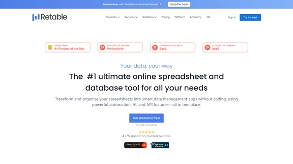
Retable AI revolutionizes how businesses handle data with intelligent automation and customizable features for seamless management.
10/19/2024

Amplitude AI Insights transforms digital analytics with instant, AI-powered answers and effortless setup.
9/13/2024
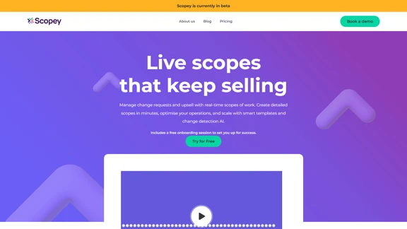
Scopey AI revolutionizes project scope management, preventing scope creep and enhancing client collaboration.
10/14/2024

Runway AI Financial empowers businesses with seamless, collaborative financial modeling and strategic alignment across teams.
10/26/2024

Salesify AI delivers real-time coaching and analytics to transform your sales team's performance and conversion rates.
10/23/2024
